

Asia Classic Map, Laminated
Asia Classic Map, Laminated
Regular price
$43.45 USD
Regular price
$0.00 USD
Sale price
$43.45 USD
Unit price
per
Shipping calculated at checkout.
Explore the vast and diverse landscapes of Asia with National Geographic's Asia Classic Map, now available in a durable laminated format for enduring reliability. Expertly researched and designed, this map stands as the authoritative reference for the continent, meticulously crafted to provide unparalleled accuracy and detail. Featuring National Geographic's signature Classic style with a bright color palette and colorful borders, this map offers clarity and readability that make it an indispensable tool for exploration and education.
From the towering peaks of the Himalayas to the sprawling coastlines of the Pacific, every geographic feature is depicted with precision, thanks to the subtle shaded relief and meticulously labeled landforms. Major water bodies, including rivers, lakes, oceans, and seas, are clearly delineated, while accurately defined international boundaries, cities, islands, and airports provide essential geographic context. Thousands of place names are strategically placed to ensure legibility, even in heavily populated areas, offering a comprehensive overview of Asia's rich tapestry of cultures and landscapes. With up-to-date international boundaries and territorial control reflecting the current geopolitical landscape, this map provides a reliable reference for students, travelers, and geography enthusiasts alike. Whether you're exploring the bustling streets of Tokyo or the ancient ruins of Angkor Wat, the National Geographic Asia Classic Map, laminated for durability, is your essential guide to the wonders of Asia.
Key Features :
i : Signature Classic style map with bright, easy to read color palette with blue oceans and colorful borders.
ii : Background shows mountain ranges and valleys in subtle shaded relief with mountain ranges labeled.
iii : Major water bodies including rivers, lakes, oceans, seas, gulfs, bays, straits, and bathymetry.
iv : Clearly defined international boundaries, cities, islands, airports, and physical features.
v : Thousands of place names carefully and artfully placed to maintain legibility in heavily populated areas.
vi : Measures 33.25" x 38"
Couldn't load pickup availability
Expected Delivery: Thu 01 Aug - Sat 03 Aug
-
TACTILE

-
PROPRIOCEPTION

-
VESTIBULAR


Bundle & Save 10% off
Includes Free Shipping

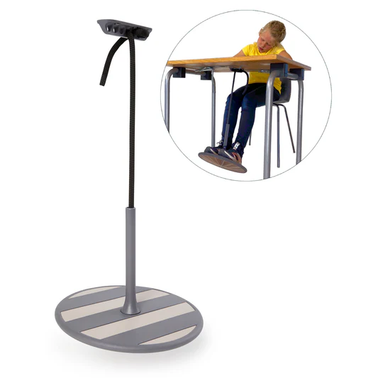
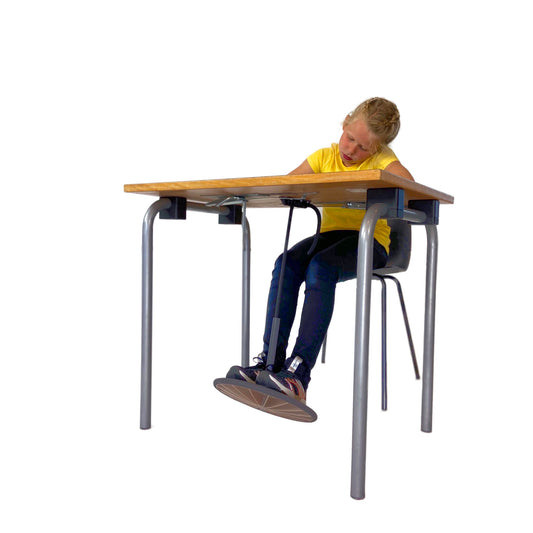
Soft Play Flexible Seat for Kids
You’re SAVING $420.99 (10% OFF)
Add bundle to cart | $420.99
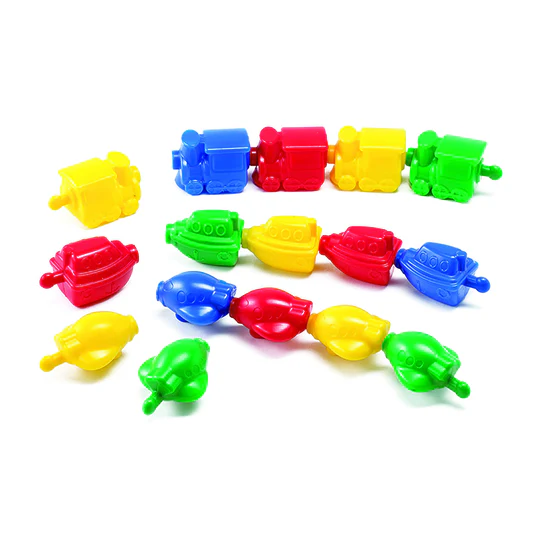
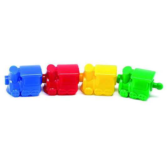
Transportation Linking Blocks, Set of 36
Regular price
$31.45 USD
Regular price
$0.00 USD
Sale price
$31.45 USD
Unit price
per
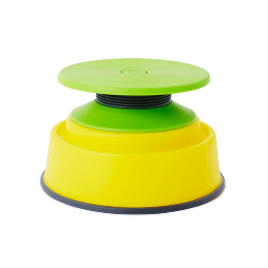
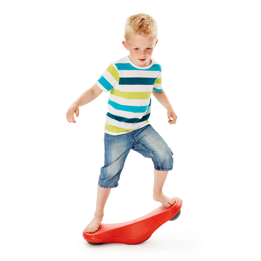
Build N’ Balance® Tilting Disc Set
Regular price
$64.45 USD
Regular price
$0.00 USD
Sale price
$64.45 USD
Unit price
per
Sold out
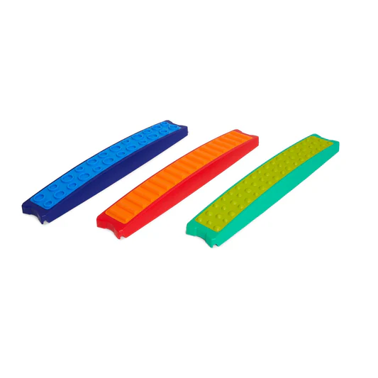
Build N' Balance® Tactile Planks, Set of 3
Regular price
$118.45 USD
Regular price
$0.00 USD
Sale price
$118.45 USD
Unit price
per
Sold out


Sensory Sound Eggs
Regular price
$42.45 USD
Regular price
$0.00 USD
Sale price
$42.45 USD
Unit price
per
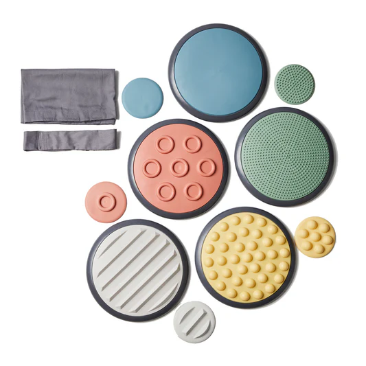

Tactile Discs Nordic
Regular price
$118.45 USD
Regular price
$0.00 USD
Sale price
$118.45 USD
Unit price
per
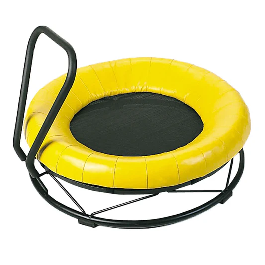
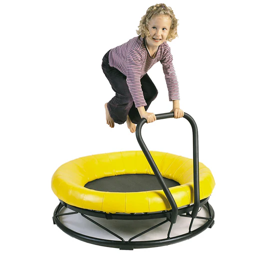
Trampoline, Mono
Regular price
$608.45 USD
Regular price
$0.00 USD
Sale price
$608.45 USD
Unit price
per


Body Wheels, Set of 2
Regular price
$326.45 USD
Regular price
$0.00 USD
Sale price
$326.45 USD
Unit price
per


Roller with Sand
Regular price
$140.45 USD
Regular price
$0.00 USD
Sale price
$140.45 USD
Unit price
per


Build N’ Balance® Bridge Pier
Regular price
$37.45 USD
Regular price
$0.00 USD
Sale price
$37.45 USD
Unit price
per


Build N’ Balance® Triangular Platform
Regular price
$64.45 USD
Regular price
$0.00 USD
Sale price
$64.45 USD
Unit price
per


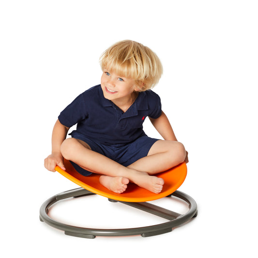
Floor Surfer®
Regular price
$156.45 USD
Regular price
$0.00 USD
Sale price
$156.45 USD
Unit price
per


Arches, Set of 3
Regular price
$162.45 USD
Regular price
$0.00 USD
Sale price
$162.45 USD
Unit price
per


Balanco Set 1, Mouse Game, Horizontal Eight and Maze
Regular price
$184.45 USD
Regular price
$0.00 USD
Sale price
$184.45 USD
Unit price
per

Tactile Discs – Set 2
Regular price
$118.45 USD
Regular price
$0.00 USD
Sale price
$118.45 USD
Unit price
per


Maze Balance Board, 24 Pieces
Regular price
$40.45 USD
Regular price
$0.00 USD
Sale price
$40.45 USD
Unit price
per


K's Kids® The Hungry Pelican
Regular price
$58.45 USD
Regular price
$0.00 USD
Sale price
$58.45 USD
Unit price
per


Pound and Roll Tower
Regular price
$41.45 USD
Regular price
$0.00 USD
Sale price
$41.45 USD
Unit price
per


Rollables Ocean Slide
Regular price
$86.45 USD
Regular price
$0.00 USD
Sale price
$86.45 USD
Unit price
per

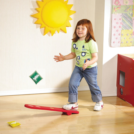


Economy Agility Ladder
Regular price
$77.45 USD
Regular price
$0.00 USD
Sale price
$77.45 USD
Unit price
per


ECO Nuts & Bolts: 28-Piece Eco-Friendly Geometric Shapes Toy | Skill-Building Fun | For Ages 3 to 7 Years
Regular price
$35.45 USD
Regular price
$0.00 USD
Sale price
$35.45 USD
Unit price
per