


World & U.S. Map Laminated Reference Guide
World & U.S. Map Laminated Reference Guide
Regular price
$19.45 USD
Regular price
$0.00 USD
Sale price
$19.45 USD
Unit price
per
Shipping calculated at checkout.
This handy notebook sized laminated map folds out to 11 by 17 inches with the World on one side and the U.S. on the other, plus an additional page of World & U.S. statistics and trivia for each map. Guide Includes: United States map Satellite imaged topography of the U.S. States & state capitals Cities labeled by human population National parks & preserves Man-made waterways, swamps & marshlands Time zone boundaries World map National capitals & large cities Satellite imaged topography of the World Distance & scale Extremely detailed boundaries and coastlines. Perfect for students of all ages and anyone interested in expanding their knowledge of the United States and the World. *Classroom bonus the large wall map can be used for the whole class while students reference their individual maps at their desks (lamination makes for durable classroom sets).
Key Features :
i : Extremely detailed boundaries and coastlines of the United States and state capitals
ii : Perfect for students of all ages and anyone interested in expanding their knowledge of the United States and the World.
iii : Classroom bonus the large wall map can be used for the whole class while students reference their individual maps at their desks (lamination makes for durable classroom sets)
Couldn't load pickup availability
Expected Delivery: Sat 20 Dec - Mon 22 Dec


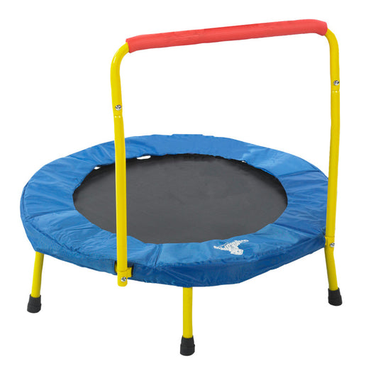
Fold & Go Trampoline
Regular price
$115.90 USD
Regular price
$115.90 USD
Sale price
$115.90 USD
Unit price
per
Sold out
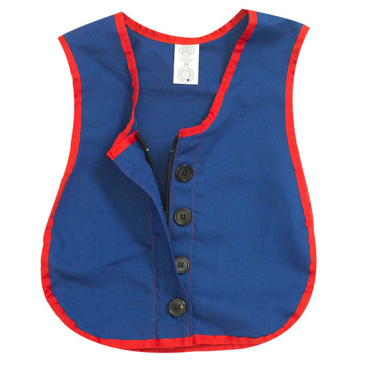
Manual Dexterity Combo Zipper/Button Vest
Regular price
$48.50 USD
Regular price
$38.80 USD
Sale price
$48.50 USD
Unit price
per
Sold out
Sold out
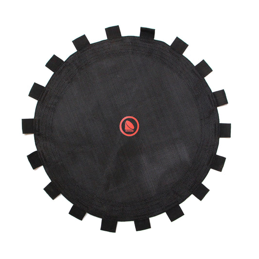
Spring sheet Baby Trampoline 2406
Regular price
$31.71 USD
Regular price
$0.00 USD
Sale price
$31.71 USD
Unit price
per
Sold out
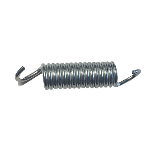
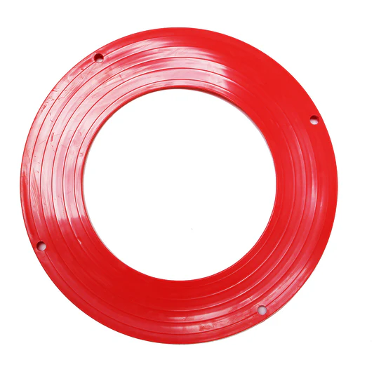
GONGE Spare Part: Replacement Spring for WING2400
Regular price
$14.22 USD
Regular price
$0.00 USD
Sale price
$14.22 USD
Unit price
per
Sold out
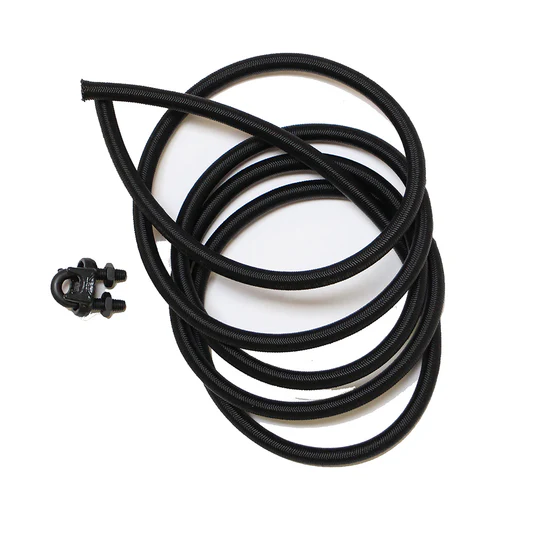
GONGE Replacement Part Baby Trampoline Elastic Replacement Bands
Regular price
$22.57 USD
Regular price
$0.00 USD
Sale price
$22.57 USD
Unit price
per
Sold out
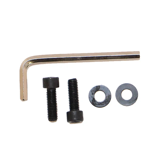
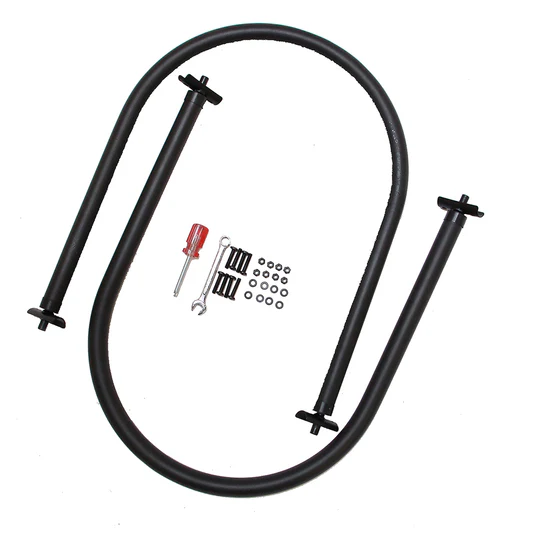
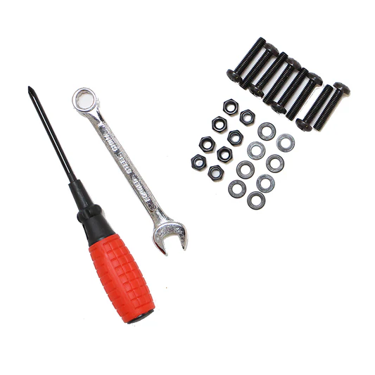
Screws+Keys: Mono Trampoline, Handle
Regular price
$14.44 USD
Regular price
$0.00 USD
Sale price
$14.44 USD
Unit price
per
Sold out
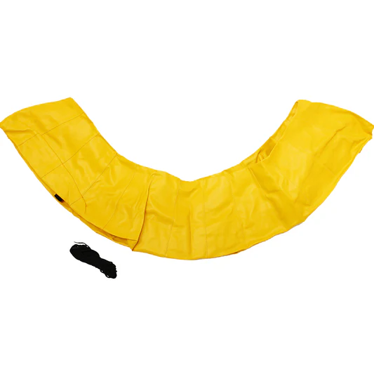
Yellow Cover for Trampoline 2400
Regular price
$55.63 USD
Regular price
$0.00 USD
Sale price
$55.63 USD
Unit price
per
Sold out
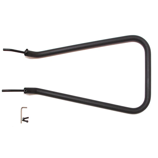
Handle for Trampoline 2400
Regular price
$57.38 USD
Regular price
$0.00 USD
Sale price
$57.38 USD
Unit price
per
Sold out

Spring Sheet for Trampoline 2400
Regular price
$35.70 USD
Regular price
$0.00 USD
Sale price
$35.70 USD
Unit price
per
Sold out
Handles for Baby Trampoline, 2 Pcs
Regular price
$71.15 USD
Regular price
$0.00 USD
Sale price
$71.15 USD
Unit price
per
Sold out
Rubber Cover for Baby Trampoline
Regular price
$57.36 USD
Regular price
$0.00 USD
Sale price
$57.36 USD
Unit price
per
Sold out
Screws+Keys for Baby Trampoline
Regular price
$65.46 USD
Regular price
$0.00 USD
Sale price
$65.46 USD
Unit price
per
Sold out
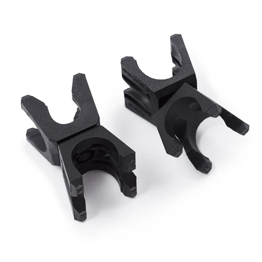

Build N' Balance® Joints, Pack of 2
Regular price
$18.19 USD
Regular price
$0.00 USD
Sale price
$18.19 USD
Unit price
per
Sold out
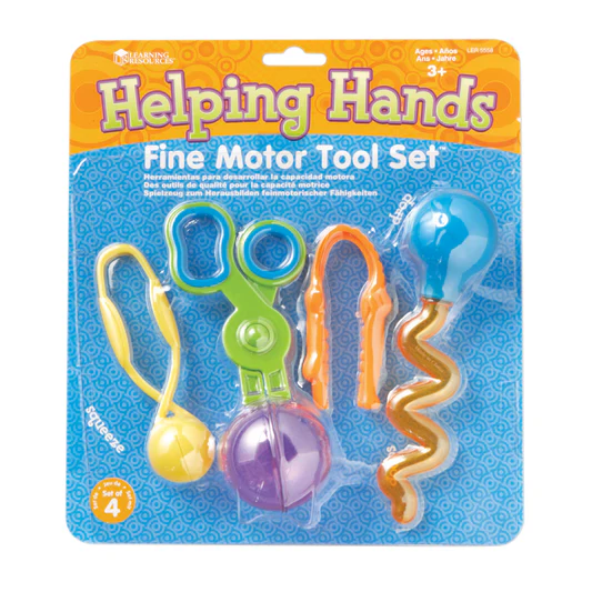
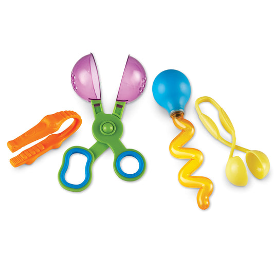
Fine Motor Tool Set
Regular price
$26.40 USD
Regular price
$0.00 USD
Sale price
$26.40 USD
Unit price
per
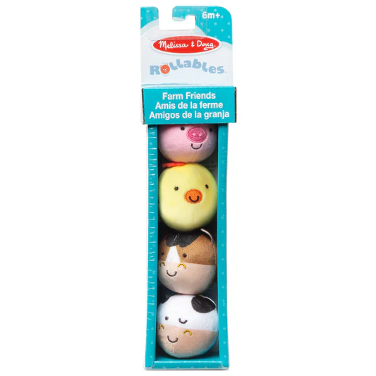

Rollables Farm Friends
Regular price
$26.44 USD
Regular price
$0.00 USD
Sale price
$26.44 USD
Unit price
per
Sold out
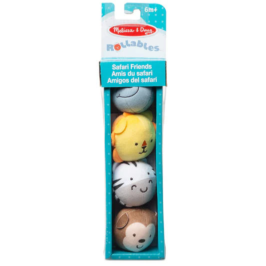

Rollables Safari Friends
Regular price
$26.44 USD
Regular price
$0.00 USD
Sale price
$26.44 USD
Unit price
per
Sold out
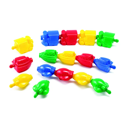
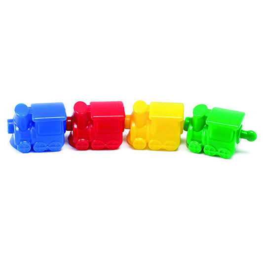
Transportation Linking Blocks, Set of 36
Regular price
$33.98 USD
Regular price
$0.00 USD
Sale price
$33.98 USD
Unit price
per
Sold out


Fine Motor Feeding Friends
Regular price
$30.45 USD
Regular price
$0.00 USD
Sale price
$30.45 USD
Unit price
per
Sold out
Sold out
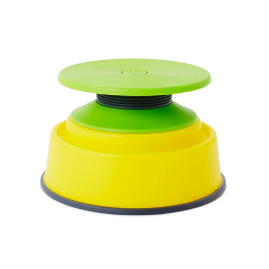
Build N’ Balance® Tilting Disc Set
Regular price
$70.91 USD
Regular price
$0.00 USD
Sale price
$70.91 USD
Unit price
per
Sold out
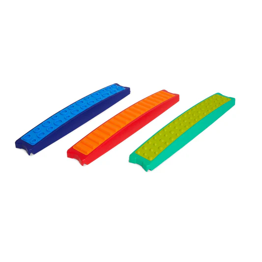
Build N' Balance® Tactile Planks, Set of 3
Regular price
$138.68 USD
Regular price
$0.00 USD
Sale price
$138.68 USD
Unit price
per
Sold out


Sensory Sound Eggs
Regular price
$40.87 USD
Regular price
$0.00 USD
Sale price
$40.87 USD
Unit price
per
Sold out